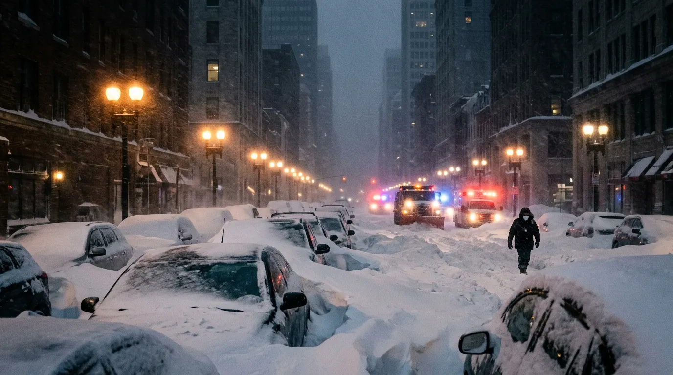
Providence, Rhode Island, woke up Tuesday morning to 37.1 inches of snow, an all-time record for the city. Newark, New Jersey, recorded 27.1 inches, its second-largest snowstorm ever. Central Park measured 19.7 inches, placing the storm in New York City's top ten. Across eight states and 40 million people, the Blizzard of 2026 delivered the kind of winter storm that meteorologists had warned about for days but that no amount of preparation could fully contain.
The storm, which the Weather Channel dubbed Winter Storm Hernando, underwent rapid intensification known as bombogenesis as it moved up the East Coast late Sunday and into Monday. It reached bomb cyclone status in the early hours of Monday morning, meaning its central pressure dropped at least 24 millibars in 24 hours. In practice, that meant hurricane-force wind gusts approaching 100 miles per hour along New England coastlines, whiteout conditions across the Interstate 95 corridor, and a paralysis of the nation's most densely populated region that will take days to unwind.
By the Numbers
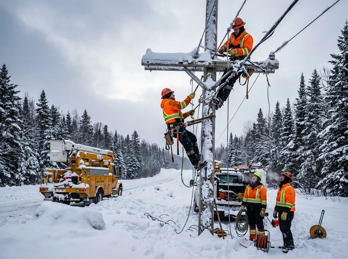
The scale of disruption was staggering even by nor'easter standards. More than 600,000 customers lost power at the storm's peak intensity, with Massachusetts alone accounting for over 250,000 outages that persisted into Tuesday. Airlines canceled more than 11,000 flights between Sunday evening and Tuesday morning. Travel bans went into effect across Rhode Island, Suffolk County in New York, and the city of Boston, effectively shutting down surface transportation for millions.
Snow totals across a dozen states read like a record book. Providence's 37.1 inches topped its previous all-time record. Norton, Massachusetts, recorded 31.8 inches. Berkley, Massachusetts, hit 31 inches. Islip, New York, measured 29.1 inches. The storm deposited at least a foot of snow in ten states, from Virginia through Maine, an unusual geographic reach that reflected the system's massive size and slow movement.
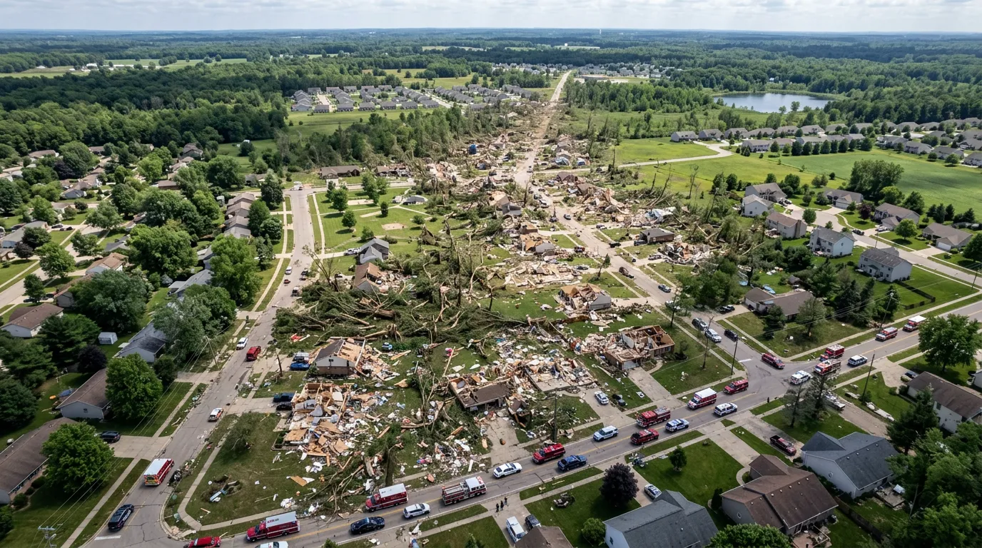
The human cost included at least seven confirmed fatalities: two in Maryland near Sunderland, two in Pennsylvania, and one each in New Jersey, Rhode Island, and Massachusetts. Most deaths involved car accidents on snow-covered roads or cardiac events during shoveling, the grim recurring pattern of every major winter storm.
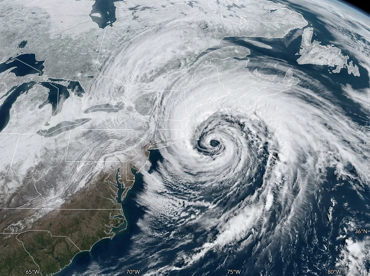
A Storm Supercharged by Warm Water
What made Hernando historically destructive was not just its track, which followed the classic nor'easter path, but the intensity of its deepening. The storm fed on ocean surface temperatures that were running 2 to 4 degrees Fahrenheit above the 30-year average for late February, according to National Oceanic and Atmospheric Administration buoy data. Warmer water means more evaporation, more moisture in the atmosphere, and more energy available to fuel storm intensification.
This relationship between warming oceans and more intense winter storms is one of the climate patterns that confuses the public conversation about global warming. A blizzard that buries cities in three feet of snow does not contradict climate change. It illustrates one of its predicted consequences. The scientific mechanism is straightforward: a warmer atmosphere holds more moisture, roughly 7% more for every degree Celsius of warming. When that moisture encounters a cold air mass, as happens every winter along the Eastern Seaboard, the result is heavier precipitation. Whether it falls as rain or snow depends on surface temperatures, which remain cold enough in February to produce record snowfall totals.
Dr. Jennifer Francis, a senior scientist at the Woodwell Climate Research Center, has documented this pattern across two decades of research. Her work shows that Arctic warming, which is occurring at roughly four times the global average rate, disrupts the jet stream in ways that allow cold air to plunge further south while simultaneously pulling more moisture northward. The result is not fewer storms but more extreme ones, storms that produce both record cold and record precipitation in the same event.
The Blizzard of 2026 fits this model precisely. Surface temperatures across the Northeast were below average during the storm, but the ocean feeding it was abnormally warm. The collision of those two conditions produced a storm that was simultaneously colder and wetter than average, a paradox that only makes sense through the lens of a rapidly changing climate system.
The Infrastructure Problem the Storm Exposed
Power restoration timelines reveal something that snow totals alone cannot: the fragility of aging infrastructure in the face of storms that are growing more intense. Massachusetts reported over 250,000 customers still without power by early Tuesday, more than 12 hours after the storm's peak. In previous nor'easters of comparable magnitude, like the Blizzard of 1978 or the 2013 nor'easter, restoration took similarly long or longer, despite four decades of supposedly improved infrastructure.
The problem is structural. The Northeast's power grid relies heavily on overhead distribution lines, which are vulnerable to both heavy snow loading and wind damage. Underground installation costs roughly five to ten times more per mile, a figure that has deterred utilities from investing in resilience even as storm intensity has increased. The result is a system that fails predictably in precisely the conditions that are becoming more common.
The same pattern applies to transportation. The 11,000 canceled flights represent not just immediate travel disruption but cascading economic effects. Airlines estimate that each canceled flight costs between $40,000 and $100,000 in direct expenses, before accounting for passenger accommodation, rebooking, and downstream delays. A rough calculation puts the airline industry's direct costs from Hernando between $440 million and $1.1 billion, with total economic losses across the affected region likely exceeding several billion dollars once business closures, lost wages, and property damage are included.
The contrast with other countries is instructive. Japan's Shinkansen bullet trains operate through snowfall that would shut down Amtrak's Northeast Corridor for days. Nordic countries maintain road networks through storms that exceed what Hernando delivered. The difference is not geography or climate but investment priorities and engineering standards designed for the storms that actually happen, not the storms of fifty years ago.

What the Recovery Looks Like
The immediate challenge is straightforward but enormous: moving millions of tons of snow off roads, runways, rail lines, and sidewalks in a region where 40 million people need to resume daily life. Cities that declared snow emergencies are beginning staged recoveries, clearing arterial roads first, then secondary streets, then residential areas. In Providence, where nearly three feet of snow fell, full street clearance was projected to take through the end of the week.
The secondary challenge is less visible but more expensive. Flat-roofed commercial buildings across the region face snow loads approaching structural limits. Building departments in Massachusetts, Connecticut, and New Jersey issued advisories urging property owners to clear roofs before the snow compacted and gained weight, a process that accelerates with the freeze-thaw cycles expected later this week.
For the 600,000 households that lost power, the recovery is not just about restored electricity. Extended outages in freezing temperatures risk burst pipes, which cause water damage that can cost homeowners tens of thousands of dollars and can take months to remediate. Insurers in the Northeast had already tightened winter storm coverage after elevated claims in 2024 and 2025, meaning many homeowners face higher deductibles than they did a year ago.
What This Tells Us
The Blizzard of 2026 will join a growing catalog of storms, from Superstorm Sandy to the 2021 Texas freeze, that expose the gap between infrastructure designed for historical weather patterns and the storms that climate change is producing. Each storm prompts calls for investment. Each time, the cost estimates seem too large, until the next storm makes them seem modest by comparison.
The specific indicator to track is federal disaster relief funding. If FEMA declares the affected states eligible for individual assistance, which typically requires sustained power outages affecting large populations, the cost will draw from an emergency fund that has been drawn down repeatedly in recent years. The pattern of escalating disaster costs, now averaging over $100 billion annually in the United States, is the financial expression of a climate system that is changing faster than the infrastructure built to withstand it. Hernando is not the last storm of this magnitude the Northeast will face. Based on ocean temperature trends and jet stream research, it is likely not the worst, either.